The history of life returned with all the colors of the palette after a huge, destructive pyroclastic flow 90,000 years ago.

Geosites

Geosites

Memories of a Wild Past

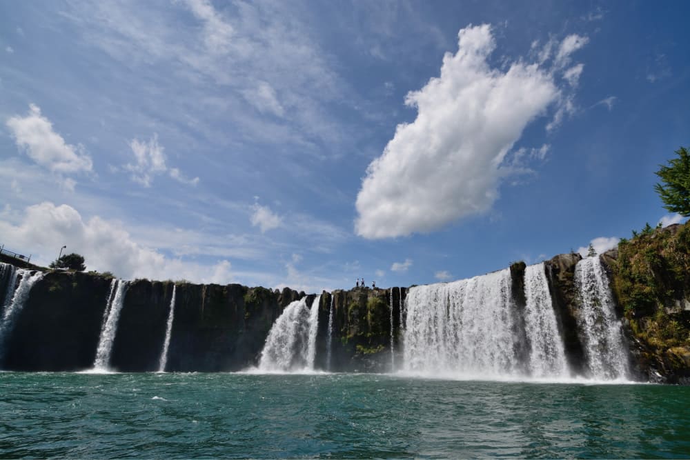
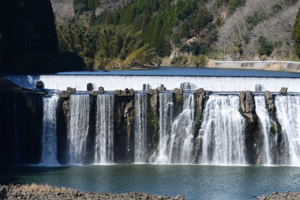
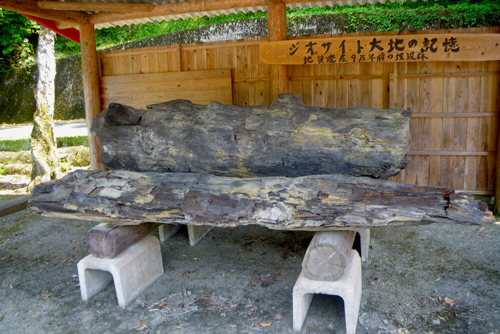
Pyroclasts from eruptions of the Aso volcano 120,000 and 90,000 years ago covered much of the land of Bungo Ono before cooling down and turning into ignimbrite. The columnar joints of ignimbrite often formed long, thin, vertical cracks which then collapsed and left spectacular waterfalls and cliffs. These waterfalls and cliffs are the very locations that serve as tourist destinations in Bungo Ono today.

Open the Side Menu to select a site.

Harajiri Falls (A-1)

These falls are part of the Ogata River, a tributary of the Ono River, and span 120 meters across and stand 20 meters tall. They formed by the collapse of the ignimbrite resulting from the cooling down of the pyroclasts from the Aso volcano's fourth eruption around 90,000 years ago. The torii gate located upstream of the falls is that of the second shrine of the Three Shrines of Ogata. In the annual Kawagoshi Festival, locals carry a mikoshi portable shrine through the gate.

Chinda Falls (A-2)

The Chinda Falls consist of the greater falls of the Ono River and the smaller falls of its tributary, the Hirai River. The greater falls span 100 meters across and stand 20 meters tall. During the Muromachi period, famous painter Sesshu created a work titled the Chinda Falls, inspired by his visit here. The falls are also home to the remains of a hydroelectric power plant built during the Meiji era.

Scenery of Iwado
(A-3)

A massive rock wall that stands at the joint between the Ono and Okudake rivers is called the Scenery of Iwado. The lower half of the cliff was formed by the pyroclastic flows from the Aso volcano's third huge eruption, while the upper half was formed by the flows from its fourth eruption. A tunnel for the JR Hohi Line runs right into the cliff face, making the location a famous photo spot for train enthusiasts.

Taizako Canyon (A-4)

Taizako Canyon is a ravine along the Okudake River flanked on both sides by columnar joint cliffs of ignimbrite. The cliffs stand as tall as 70 meters. The valley floor is home to exposed rocks that came from volcanic activity around 15,000,000 years ago. Further upstream there is even a cave where trees burned by pyroclastic flow are buried.

Buried Trees in Matsuo (A-5)

These tree trunks, kept on the grounds of the former Mie-minami Elementary School (now Akai Yane no Sato), were once buried at the bottom of a nearby stream. Pyroclasts from the Aso volcano flowed over the mountains, sweeping down on the trees as they went. These trees were buried under the pyroclasts, and smothered by their heat. You can see evidence of this in the black charred surface of the tree trunks.