The history of life returned with all the colors of the palette after a huge, destructive pyroclastic flow 90,000 years ago.

Geosites

Geosites

Rich Waters and Lush Nature

The natural landscape with thick greenery was reborn when waters began to run once again on the lands buried under the pyroclasts. The Bungo Ono area is lush with nature, spreading out from the Ono River, one of Kyushu's most outstanding waterways, to the Sobo-Katamuki Mountain Range, habitat for precious plant and animal life, and also to the natural forests surrounding the rural town area.

Open the Side Menu to select a site.

Kawakami Canyon
(B-1)

The Kawakami Canyon is situated at the highest upstream of the Okudake River and makes a great location to visit year round, with budding plant life in spring, cool temperatures in summer, and colorful foliage in fall. White granite rock covers the riverbed, prominently contrasting the rich woodlands surrounding the river. The area is also home to rare, endangered plant species.

Sobo-Katamuki Mountain Range (B-2)

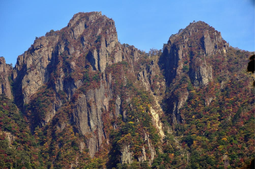
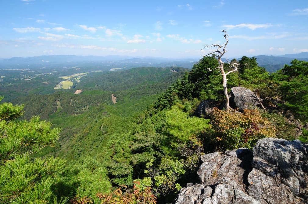
Listed among Japan's 100 Best Mountains, Mt. Sobo stands 1,756 meters high. The ridges that run from it to Mt. Furusobo, to Mt. Hontani, and across to Mt. Katamuki present a unique landscape with steep rock walls. The area is designated as the core area of a UNESCO Biosphere Reserve for being inhabited by such living treasures as the Akebono-tsutsuji azelea which blooms here in spring, and the Japanese serow, one of the Special Natural Monuments of Japan.

Tedori-gando (B-3)

At Tedori-gando, strata belonging to the Onogawa Group which formed by sediments accumulated on the ocean floor around 90 million years ago are exposed after the layers above have been washed away by the swift current of the Ono River. The strata greatly changed their positions in the crustal movement, now looking like slanted door panels. The river flows so swiftly here that even crabs traverse over the face of the rocks above the water to avoid getting swept away. People could catch those crabs with their hands, from which the name “Tedori-gando” is said to come.

Enaido Landscape
(B-4)

The Ono River is now one of Kyushu's most outstanding waterways. After eruptions of the Aso volcano left these areas smothered with pyroclasts, it was this river that eroded away the lands, giving birth to the flat plains on both sides. The splendid view of the river leisurely flowing through the region’s breadbasket is called Enaido Landscape, which can be seen from the Roadside Station Mie.

Mt. Ondake (B-5)

Mt. Ondake stands just 568 meters tall, but the view from the summit is a spectacular panoramic look over Bungo Ono. The boulders atop the mountain are made of chert, which is composed of accumulations of plankton that originally sat at the bottom of the Pacific Ocean, but wound up on the islands of Japan due to the earth's shifting plates. This area is also where the Ondake-kagura ritual dances originated.

Hakusan Valley (B-6)

Listed as one of Japan's 100 Best Spring Waters and Rivers, Hakusan Valley is known for the fireflies that dance through its skies every summer. Columnar joints made from the pyroclasts from the Aso volcano line the sides of the river, presenting a rich, changing landscape. It is also home to the Inazumi underwater limestone caves, believed to have flooded due to the pyroclastic flows from the Aso volcano.